Customize Consent Preferences

We use cookies to help you navigate efficiently and perform certain functions. You will find detailed information about all cookies under each consent category below.

The cookies that are categorized as "Necessary" are stored on your browser as they are essential for enabling the basic functionalities of the site. ... 

Always Active

Necessary cookies are required to enable the basic features of this site, such as providing secure log-in or adjusting your consent preferences. These cookies do not store any personally identifiable data.

No cookies to display.

Functional cookies help perform certain functionalities like sharing the content of the website on social media platforms, collecting feedback, and other third-party features.

No cookies to display.

Analytical cookies are used to understand how visitors interact with the website. These cookies help provide information on metrics such as the number of visitors, bounce rate, traffic source, etc.

No cookies to display.

Performance cookies are used to understand and analyze the key performance indexes of the website which helps in delivering a better user experience for the visitors.

No cookies to display.

Advertisement cookies are used to provide visitors with customized advertisements based on the pages you visited previously and to analyze the effectiveness of the ad campaigns.

No cookies to display.

Tracking ecosystem stability across boreal Siberia

Forests around the world are under immense pressure from human land use and climate change, however vastly improved remote sensing techniques can help identify where forests are under greatest stress from a wide range of human-caused and climate risks.

Forests around the world are under immense pressure from human land use and climate change. Old-growth and primary forests have been continually targeted and degraded in recent decades, yet are generally more resilient and resistant to climate change effects, when compared to human-modified forests.

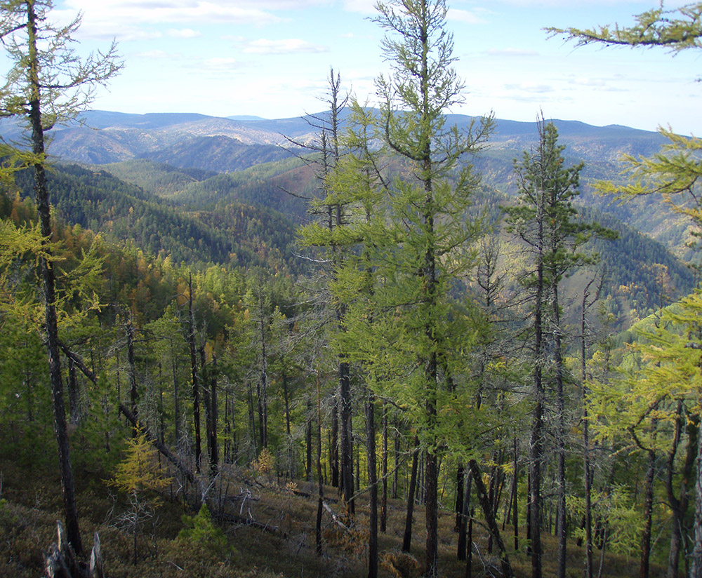
Nowhere is this more evident than in Russian Siberia, which contains almost one-fifth of the world’s forest area and has been subjected to a variety of land uses and disturbances since the mid-20th century. Although a number of related geospatial products exist, there are no large-scale maps of old-growth and primary forests across Siberia.
However, remotely sensed metrics of 'forest stability' have been shown to relate to old-growth and primary forests in tropical and boreal environments.

A forest stability index (FSI) is based on time-series analysis of fPAR and SIWSI and provides useful insights into how forest canopy processes (e.g., photosynthesis, plant water use) respond to natural and anthropogenic disturbances such as drought, logging or altered wildfire regimes. FSI trends can be used to distinguish stable from unstable forests, including the effects of past disturbances and those occurring during the time series.

In this study we applied ecological stability indices from the Moderate Resolution Imaging Spectroradiometer (MODIS) sensors across imagery of boreal forests in Siberia between 2003 to 2020. Our results indicate that forests in the central and southern 'Taiga' contain most areas of high stability, but also distinct zones of disturbance and low stability.

Our study identified three regions with particularly low forest stability:

  1. Zabaikal region in southern Siberia;
  2. a portion of the central Taiga spanning the Republic of Sakha (Yakutia); and
  3. West Siberian lowlands.

Our FSI approach has been shown to be useful in monitoring Siberian boreal forest condition, and could be applied to other boreal forested regions to identify all types of forest stress, including that caused by direct human activities, natural disturbances or related to climate variability. Such an approach can providing a more complete picture of forest condition in the face of global change.

Article authors

Tatiana Shestakova

Tatiana Shestakova

Tatiana is a post-doctoral researcher at Woodwell Climate Research Center research. Her interests span the fields of terrestrial ecology, stable isotope biogeochemistry, ecosystem modelling and climate change impacts on natural ecosystems.
Brendan Rogers

Brendan Rogers

Dr. Rogers investigates how boreal forests are responding to climate change and land use, how this feeds back to climate change, and how management and policy can be used for mitigation and adaptation.
Dr Brendan Mackey

Brendan Mackey

Project Director and Director of the Griffith Climate Action Beacon at Griffith University, contributing to community planning and engagement in forest projects.
Sonia Hugh

Sonia Hugh

Sonia is a GIS modelling expert at multiple scales, specialising in visualisation of geographic data and spatial and temporal ecological modelling.
Pat Norman

Patrick Norman

Pat is a spatial research scientist focusing on the environment, forests and protected areas.

Additional authors

Elena Kukavskaya

Reference

Shestakova, T. A., Rogers, B. M., Mackey, B., Hugh, S., Norman, P., & Kukavskaya, E. A. (2024). Tracking ecosystem stability across boreal Siberia. Ecological Indicators, 169, 112841. https://doi.org/10.1016/j.ecolind.2024.112841