Kayapo territory, Brazil

Kayapo Indigenous Territory, Brazil

The Kayapo protect forested indigenous territory in the highly-threatened Amazon

The Brazil case study focuses on a 20+ year alliance between conservation NGOs and the Kayapo Indigenous People. The block of Kayapo Indigenous Territories is of particular conservation importance because it spans almost 11 million hectares of Amazonian rainforest interspersed with patches of tropical savanna. Kayapo lands form the last large tract of forest that survives in the southeastern Amazon.

International Conservation Fund of Canada

ICFC is Canada's leading international conservation organisation and partners with local conservation organisations in Latin America, Africa and Asia. Their work is science based, committed to engaging local communities, and securing lasting conservation gains. More about International Conservation Fund of Canada.
International Conservation Fund of Canada

Survival Revolution: The Kayapo Identity

The story of the Kayapo and their battle against external threats to territory and culture.

[Video: WILD Foundation]

Kayapo Indigenous Territory

The Kayapo people number some 10,000 people living in more than 80 communities. They gained official land rights over an area of five contiguous Indigenous Territories in struggles with the government during the 1980s and 1990s. The 1988 Constitution of Brazil grants indigenous people permanent and exclusive usufruct rights (the right to harvest and profit from) over their legally demarcated territories.

Amazon basin

Kayapó Indigenous Territory in the Amazon Basin.

Threats

Kayapo lands are located in one of the world’s highest deforestation zones. Threats have continued to increase over the three to four decades since official demarcation of Kayapo indigenous territory and can be summarised as lack of governance.

Illegal logging, gold mining, fishing, and land-grabbing are rampant in the region. Loggers and gold miners are unceasing in their attempts to gain entry to Kayapo lands, and when they do, the destructive impacts of their activities on the environment and indigenous culture are severe and overwhelm attempts at control.

Matters worsened in 2019 when the new Bolsonaro government took steps to weaken indigenous rights and open indigenous territory to industry. Presidential declarations, combined with a weakening of the government agencies responsible for the protection of Indigenous and protected areas, further increased pressure by illegal actors on 9.4 million ha of intact, resource-rich Kayapo land.

Approximately 1.2 million ha of an eastern band of the Kayapo’s 10.6 ratified territory has been lost to illegal activity and frontier society because for historical reasons the Kayapo of this area never allied with conservation NGOs and, therefore, do not receive conservation and development investment (see Map 1, below).

Today, the Kayapo face a choice between unsustainable, illegal, but in the short term, high-value activities that lead to inevitable environmental and cultural degradation and loss of territory; or long term, lower-value, conservation-based enterprises that take longer to develop but are sustainable, legal, equitably benefit all community members and empower territorial control.

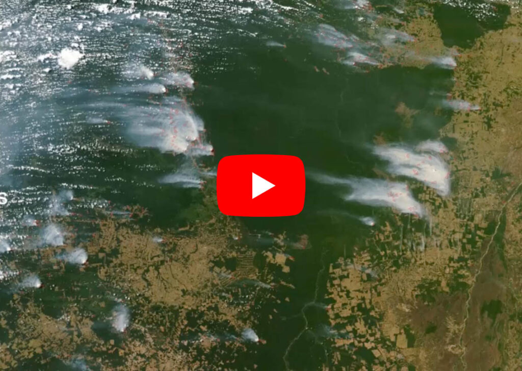
Forest cover and fire comparison

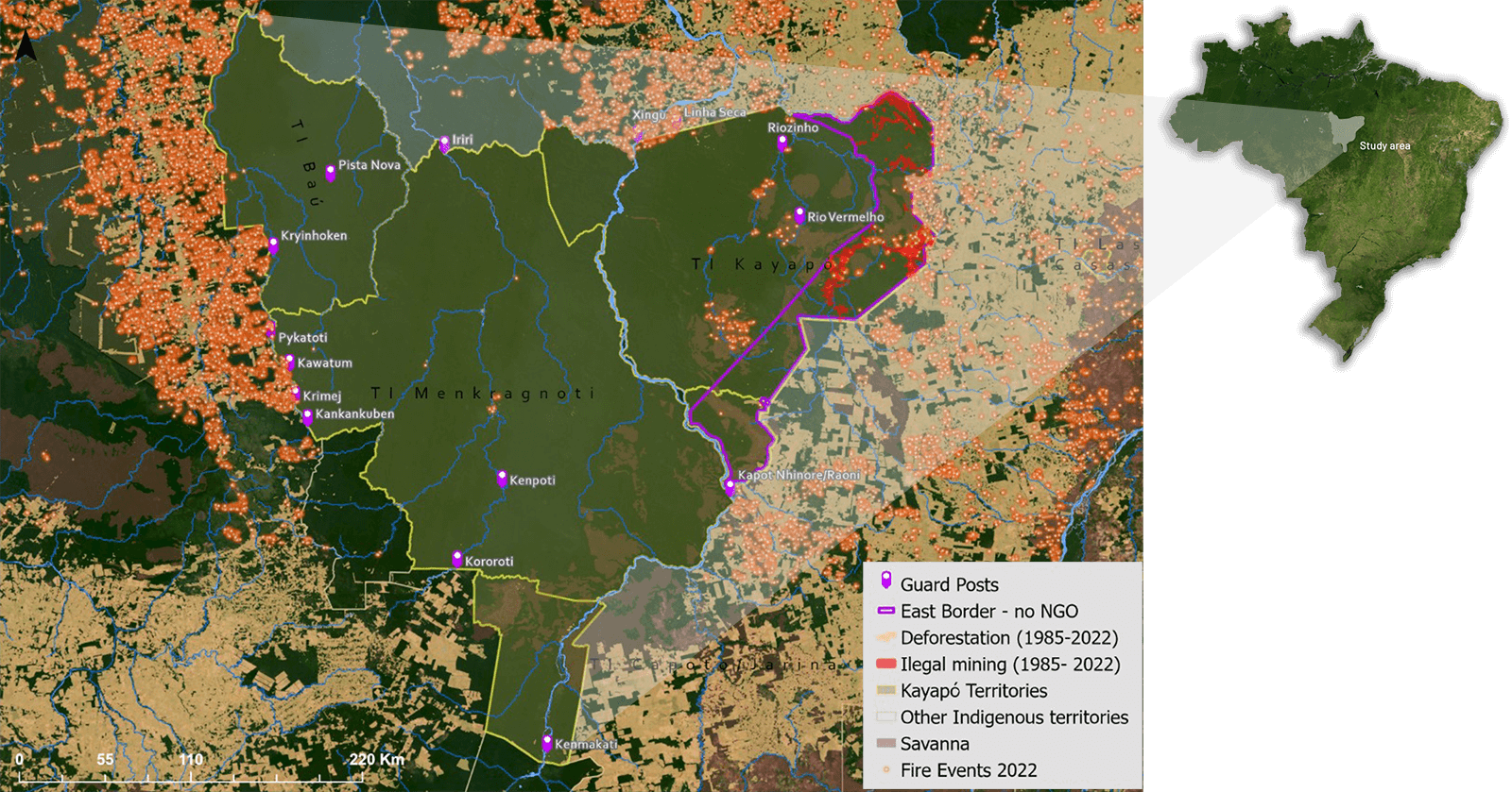
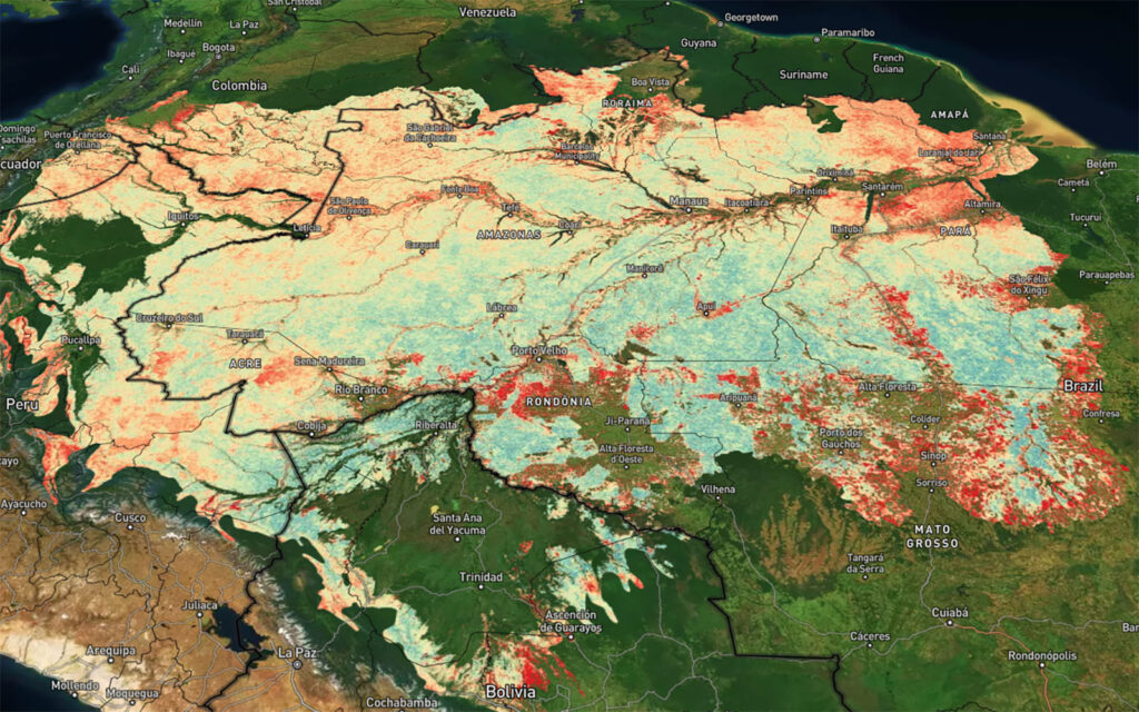
Map 1. 2022 fire and deforestation events in 9.4 million hectares of the block of Kayapo territories (outlined in yellow) that receives philanthropic investment remains intact whereas 1.2 million hectares of Kayapo territory that does not form part of the NGO alliance (outlined in purple) and receives no conservation investment is heavily invaded by goldmining and logging. (note: fire on naturally occurring savanna patches is normal during the summer dry season and does not indicate anthropomorphic deforestation).

Kayapo territory maps

Kayapo families in the Amazon life a traditional, albeit modified way of life.

Kayapo families in the Amazon life a traditional, albeit modified way of life. (Photo: Martin Schoeller.)

Kayapo man carving a canoe

Kayapo people of the Amazon basin. (Photo: Martin Schoeller.)

Solutions & responses

In the early 2000s lawless frontier society threatened to overwhelm traditional defense and the Kayapo sought alliances with conservation NGOs to gain the capacity for territorial control.

The Kayapo- conservation NGO alliance has enabled the Kayapo to prevent invasion by illegal loggers, goldminers, fishermen and ranchers and continue to protect more than nine million hectares of their land. The key to protection of this vast forest tract has been philanthropic investment that supports the Kayapo to:

  • develop sustainable enterprises that generate equitably distributed income;
  • implement territorial monitoring and control along 2,200 km (1,375 miles) of border and over nine million hectares of ratified Kayapo territory;
  • manage their own local NGOs to deal effectively and gain a voice in outside society.

Sustainable enterprises

The three Kayapo NGOs have developed a portfolio of growing sustainable enterprises, including: ecotourism and commercialization of brazil nut, cumaru nut, garden produce, cocoa, and handicrafts.

Sustainable, non-timber product enterprises generates equitably accessed income for Kayapo communities. Equitably distributed, conservation-based income unites community members against attempts by illegal loggers, gold miners and fishermen to buy their way into Kayapo territory.

Territorial surveillance

The core of Kayapo territorial surveillance is a series of border guard posts (MAP 1) that form the shield behind which other conservation and development programs can develop and grow.

The guard post program supports organisation and administration for the Kayapo to monitor and defend 2,200 km (1,375 miles) of their border demarcating their protected forested territory from deforesting frontier society. Kayapo guards are paid a day rate and work at the guard posts in weekly shifts on a rotating community-by-community basis, with the number of weeks allocated to each community in proportion to population size. This rotation ensures equitable distribution of income. As with sustainable enterprise, equitably distributed income forms a powerful antidote against bribes by illegal actors.

In addition to their vital role in controlling access to Kayapó territory, guard posts are bases of learning and capacity building for Kayapo youth and young leaders.
Other components of Kayapo territorial monitoring and control include: expeditions by land and river, satellite image analysis (GIS), and overflights.

Kayapo Indigenous NGOs

International conservation NGO partners support management and administration of the three Kayapo indigenous NGOs that represent respectively communities in the northeast, northwest and southwest sectors. Kayapo NGOs are portals to outside support, poles of organisation and sources of information and capacity for the Kayapo to navigate and deal in a foreign world. High functioning local indigenous NGOs are the foundation for successful program implementation by the Kayapo.

Territorial and environmental management plans

Additionally, the three Kayapo NGOs are in the process of developing with their communities territorial and environmental management plans for their respective indigenous territorial areas.

Official government policy Política Nacional de Gestão Territorial e Ambiental de Terras Indígenas (PNGATI) mandates that Indigenous territories should have indigenous territorial and environmental management plans in place to form a foundation or roadmap for sustainable development and territorial protection that has been defined by the indigenous inhabitants themselves.

Research articles from case study site

Mapping forest stability within major biomes using MODIS time series

Forest stability is a key component of ecosystem integrity and primary forests. Current remote sensing products largely focus on deforestation rather than forest degradation, and depend on machine learning calibrated with extensive field measurements. To address this, we used MODIS time series to develop a novel approach for mapping forest stability across forest biomes.
Fires on the Amazon fringes

Legal protection of the Amazon: Current and future Trends

The recent Amazon fires of 2019 and 2020 have heightened attention on the region and brought the question of Amazon conservation to the forefront of international debate. The crucial role of primary forests, such as the Amazon, in preventing catastrophic biodiversity loss and climate change is largely recognised in the scientific literature and in policy forums.
Kayapo family

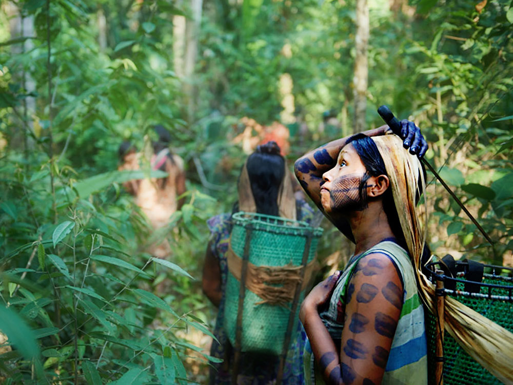
REDD+ and forest protection on indigenous lands in the Amazon

This study focuses on REDD+ as a market-based mechanism in the voluntary carbon market. It assesses the viability of using REDD+ on Indigenous lands, in this case the Brazilian Amazon and examines three key aspects of REDD+: the legal, technical and market requirements.
Kayapo women carrying items

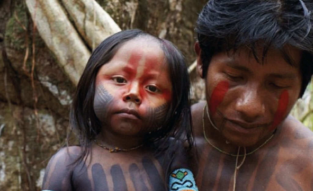
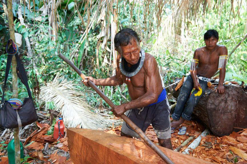
Large-scale forest conservation with an Indigenous People in the Amazon

This book chapter examines the struggle of the Kayapó to protect their constitutional territorial rights in the highly-threatened southeastern Amazon of Brazil. 21st century alliances of the Kayapò with conservation organisations have enabled protection of over 9 million hectares of their contiguous ratified territories.